Last year when we hit Moab after the trip, we got in some of the classics like Porcupine Rim. Unfortunately, our last ride there was tainted by my issues with the exposures and a mini melt down on Captain Ahab. After that, I wanted to go back - test myself with the exposure and the technical riding of Ahab. We drove from St George straight to Moab, hoping to beat the forecasted storm moving in. As anticipate, the weather on Monday wasn't idea - raining most of the morning in the city and generally cold and cloudy. Perfect day for chores and laundry! After a week of riding in St George and Hurricane, we had a bunch of laundry....
 |
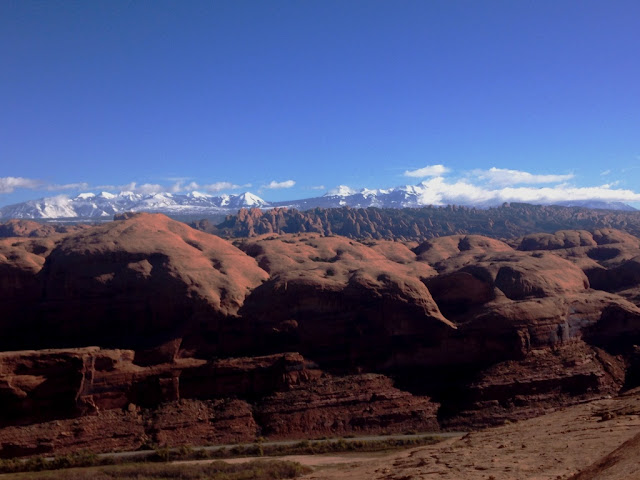
| View from Pothole Arch - LaSals covered in snow from the storm the previous day |
Tuesday was Ahab. Since it was our second trip to that trail system, we knew a little more then last year - and had a better map. We took Hymasa all the way up, riding easy and steady. Much more fun then fussing with the huge steps on Amasa Back. Hymasa really was put together well, with good flow over the rocks and still plenty of challenge and views. As we took the jeep road Cliffhanger out to the Pothole Arch trail, I really couldn't remember anything. I knew we'd ridden it, but I didn't remember. I remembered more about Pothole, following the blue lines across the sandstone and the expansive views where the trail ended. Instead of taking the left down Rockstacker, we stayed on Pothole back to the jeep trail. I could tell that Nick wanted to ride Rockstacker again, but this was my ride and we didn't. Maybe next time - but my primary goal was to ride Ahab and have fun. And fun was had. It was like riding a brand new trail! Every corner revealed something new that I didn't remember. And I loved it. Such a great trail. I even figured out why it was named Captain Ahab - there's a huge rock that the trail circles that looks just like a whale from most angles. The fact that I'd completely missed that last year was kinda shocking to me - it's so right there if you just look around.
 |
| Smiling this time around! It was never too warm on any of our Moab rides this year. |
Wendsday was time for something completely new - not just something I couldn't remember. We wanted to do Mag 7, but were too late in the season for a shuttle. Scratch that idea at that point in the trip - there was no way I wanted to ride all the way up from town to the start of Mag 7. So we studied the map a little more and decided on a route. With the rain Moab had gotten on Monday, the sand of Poison Spider should be okay to ride through. And we could make a good loop out of that - up Poison Spider, then Golden Spike and returning on Gold Bar Rim and Portal. Perfect. One thing that I have learned over our few trips to Moab is that just because something is a "road" on the map doesn't mean it's easy. Both Poison Spider and Golden Spike had some hard stuff. It was near constant climbing, up from river level, then across the mesa. Once we got on Golden Spike, the road got a little harder, snaking between huge rock formations and up narrow canyons. I really don't see how anyone could drive a jeep up through that - but I know they do. There were plenty of tire tracks to prove it.
 |
| Nick checking out the drop down to the valley from Gold Bar Rim trail |
Even with a good map, we almost missed the first junction with Gold Bar Rim. We'd had two choices - ride all the way out the start of Gold Bar or the jump in half way, depending on how long the climb up took. Well, it was nearly two hours and we weren't quite sure how much longer it would take to get to the start of Gold Bar. Time to start looking for the trail junction. On happenstance, we went out to an over look and there it was - the mountain bike trail crossing the jeep road. Perfect! Gold Bar Rim - wow. The little sampler of that trail was enough to make me want to ride the entire thing. Hard but fun technical riding, dancing with the rim of the canyon. In and out of the rocks, with every line ridable, but some requiring some through and guts. And then came Portal. The first section wasn't took bad, but the edge was uncomfortably close. And when there's a sign saying people have died and be ready to dismount? Yeah... As the trail snuck closer and closer to the 300 foot sheer plummet down to the Colorado River, I was getting closer and closer to getting off. There was nothing major technical on the trail - it was actually pretty wide by singletrack standards. But there was also nothing but air over my left shoulder... I got back on my bike after the death rock to tackle to final descent down to river level. And I was less then two minutes away from the "safety" of the road only to get kicked off the trail by a babyhead. Into a prickly pear cactus I tumbled. There was no avoiding the spines....
 |
| There is a trail there! Nick's orange helmet is on the right, upper third. The little white dot is actually a sign warning riders to not attempt the next rock. Can't understand why.... |


Comments
Post a Comment