The loop seemed pretty straight forward when we looked at on the map. Leave the campground, cruise down 50 till County 210 and then head west(ish) until we reached the Little Cochetopa Trail. Then it was just shy of 4 miles of trail to the reach the Continental Divide, with maybe the last mile requiring some hike-a-bike. Even the trail looked pretty clear cut - stay north of the creek for halfway, little jaunt to cross the creek twice, then climb up out of the marshy area before the push to the pass. Once at the summit, fly down to the Monarch Crest Trail just before Agate Creek and then ride north to Greens Creek. From there it was all downhill until we reached 50 again to return to the campground. At least that's what it looked like on the map...
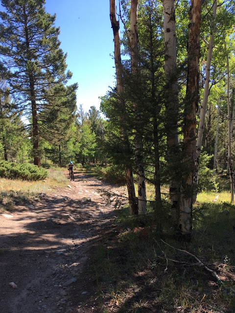 |
| Pedaling up 210 - not a bad start to the ride! |
It was that simple for the 10 miles. The county road was easy pedaling despite the gradual climb. Even when it turned to a forest service road, it was still pretty smooth pedaling. A little rockier and a little steeper but nothing too crazy. And it was quiet. There was no traffic at all - no 4-wheelers, no cars, no hikers. Just me and Nick. It was great. We got onto the trail, realizing that it might be a little overgrown since we hadn't seen anyone at all. On that nice of a day on a weekend, every other trailhead in the area would be crawling with people. For the first few miles, it wasn't too bad. Intermittent riding and pushing, with most of the pushing due to trail conditions. And it was so pretty back in that rarely traveled corner of the woods. So rarely traveled that we were making more noise then usual do deter any wildlife we might encounter. Nick was concerned about bears at that point. We were in the valley below Mount Ouray, with steep walls looming above us on both sides. Far off in the distance was the end of the valley - the pass we would have to push up to reach the Continental Divide.
We knew at some point we would be crossing the creek to avoid a marshy area and some small lakes. So when the trail we'd been following dipped down to cross a small creek, we thought nothing of it - but there was still water to our south, which should have been the first clue that something wasn't quite right. And then we saw the first moose. A medium sized bull that seemed somewhat annoyed, but not pissed that we had disturbed him. Doing our best to keep our eyes on the moose, we pressed forward on the trail. Until it vanished. Gone. Poof. Okay, maybe we'd missed a turn? We started backtracking a little on the known trail since Nick remembered seeing a turn to the south a little bit back. But that meant we lost sight of the moose... We didn't go back that far (and looking at some new data, we should have gone a little further) and decided to head back to the marsh. Somehow, we must have missed the trail in the marshy area. Once again, we pressed forward. It really looked somewhat, sorta like a trail - just a little taken over by the water. But we were making forward progress, so it couldn't be that bad, right? Then we saw the second moose. This one a female. Who knew if there was a calf around? We didn't stick around long to figure that one out. Time to head up!
 |
| Yeah, that's no deer, that's a Moose!! |
And by up, I mean UP. Even though we knew the trail followed the creek for a while longer, we didn't know where the trail was and we didn't feel like tangling with an unknown number of moose. So we went pretty much straight up the slope, gaining ground away from the marsh and the creek. Have you ever pushed/carried your bike straight up a hillside? It's not the fastest thing in the world... We were completely off the trail. We both knew we were off the trail, but we also felt safer away from the moose. And as long as we kept heading west, towards the wall of rock forming the divide, we would be fine. Yeah... If anyone asks, pushing your bike through an aspen thicket isn't the kind of character building I want to repeat any time soon. And I wasn't even breaking trail!
Finally we merged back with the trail. All of a sudden, it just reappeared! With a sigh of relief, we continued heading west. With a trail to follow, it wouldn't take us that long to get to Monarch Crest trail, would it? Normally an adventure like this wouldn't be an issue - we both have the gear to hunker down for the night if needed. But this time, we were camping with Nick's cousin and uncle. We'd told them we'd be gone for about 4 hours, not realizing the nature of the adventure we were about to embark upon. Amazingly, when we were up high off the trail, I had service and was able to text them that all was good, just slow going. We stopped at an old cabin for a few minutes and then forged on. A cairn was just beyond the cabin and I breathed a sigh of relief. Cairns meant that we would have something to follow, right? Nope. Once again, the trail just went poof. From a well worn path to nothing at all. Seriously? How could the trail just vanish into nothing? Some more bushwacking complete with choice words as the trees shredded our arms and legs. We were so close! We could see the pass just ahead of us! But how the hell to get there if the trail kept vanishing? Just keep heading west.
 |
| Pretty cool old cabin out in the middle of the woods |
Then another faint path and cairn appeared. Were we back on the trail? And would it last until the pass? The answer finally was yes. Back on the trail, following cairns through the treeline to the Continental Divide at nearly 13,000'. Even that was a long slog, with nothing but the cairns and a faint line of a trail. We flushed out two elk just below treeline, startling both Nick and I. But the end was in sight. Just a little longer and we'd be able to actually ride our bikes instead of pushing them!
 |
| Above treeline, looking back at the valley we just climbed |
 |
| Yes, we are on the trail at this point! Don't you see it right there? |
We descending off the divide, merging with the Monarch Crest Trail. We turned right, heading north. My bad joke of the day? The late hour meant we didn't have to deal with any traffic coming at us! And now I know why the stretch from Green's Creek to Agate Creek is such a kick in the pants during Vapor. That's an ugly climb up - but a super fun descent back to Greens! Finally, after nearly over six and a half hours of riding, pushing and bushwacking, we were at the top of Greens. Time to point the bikes downhill and get back to the van.
Is Little Cochetopa Trail worth the detour of the Crest? Not in my mind. Expecting a cool descent and having the intermittent trail issues limiting the ability to ride would really be awful when there are so many other cool trails off the crest. If I could figure out how to stay on the trail to complete the loop, then it might be worth it. But the trail needs a lot of work and a lot a signage for that to happen. Looking at my GPS, there were times we crossed the trail but had no clue we were actually on the trail. It took us 3:30 to go 3 miles...


Comments
Post a Comment